Sports and activities in Mojácar
Mojácar is a fantastic place to enjoy a multitude of different activities throughout the year. Its warm Mediterranean climate and its location by the sea with numerous natural spots far from the crowds allow the practice of numerous sports in the best conditions.
There is no doubt that the beaches of Mojácar are an attraction for all sea lovers. Its coastline has become a reference point for divers and scuba divers from all over Europe due to its varied marine fauna and the quality of its waters. Inland, the hiking routes and the hundreds of kilometres of roads that cross unique landscapes are of great interest to lovers of nature and sports such as cycling.
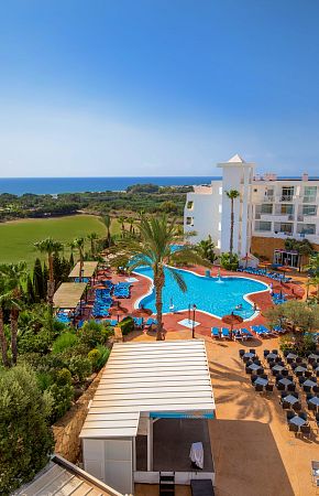
In addition, the Servigroup Hotels Marina Playa and Marina Mar are integrated in the Marina de la Torre golf course, on the seafront, and have complete facilities for sports such as paddle tennis and bowling.
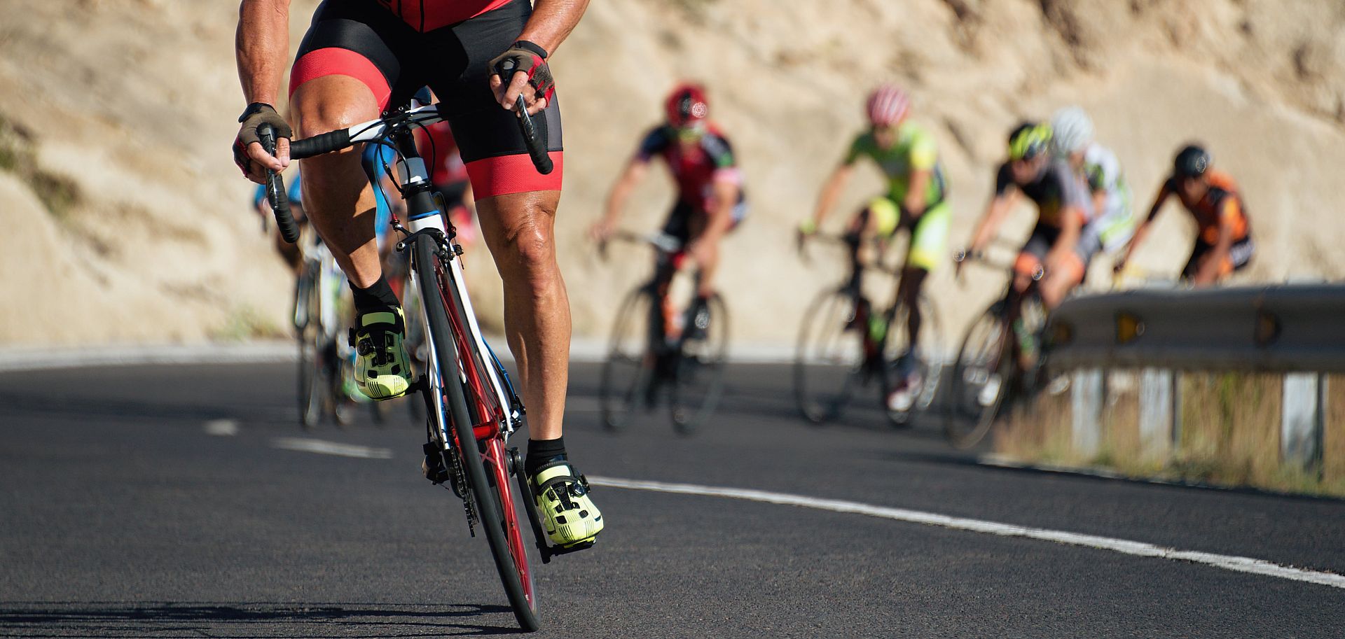
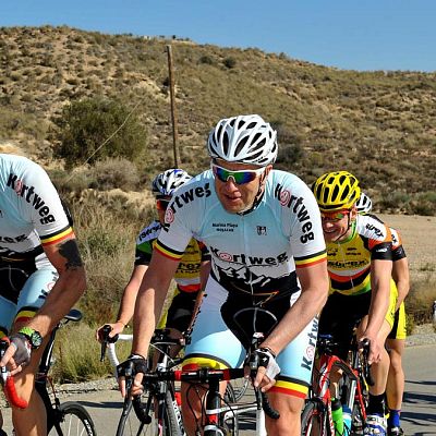
Cycling
Mojácar is an excellent choice for cycling. Thanks to its well surfaced roads with little traffic, which combine hilly and flat stretches, many national and international professional cycling teams train here. Especially during the winter, they take advantage of the mild climate and the lack of rainfall.
Fans of this sport also find Mojácar the ideal destination thanks to a route that runs through landscapes of great beauty by the sea in such special places as the Cabo de Gata Nature Reserve and the Tabernas Desert.
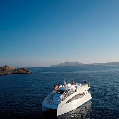
Aquatic
Mojácar's 17 km of coastline and its mild climate all year round make it the best place to practice all kinds of water sports related to the sea.
But not only that, the Cuevas del Almanzora reservoir located in the heart of the Tabernas Desert offers a unique experience to enjoy sports such as rowing or water skiing in an exceptional setting surrounded by the aridity of the Almerian terrain.
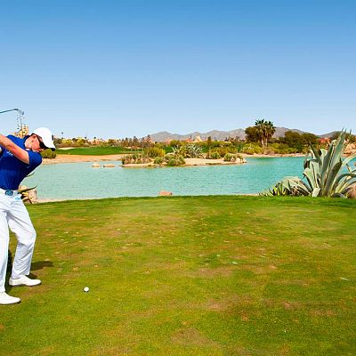
Golf
Mojácar is one of the places in Europe where you can enjoy golf the most days of the year thanks to its classic Mediterranean climate with a very mild winter, with many hours of daylight and almost no rainfall.
The golfer can enjoy up to 5 first class golf courses located in the surroundings of the municipality very close to the sea and perfectly equipped. Without a doubt it is one of our favourite sports!
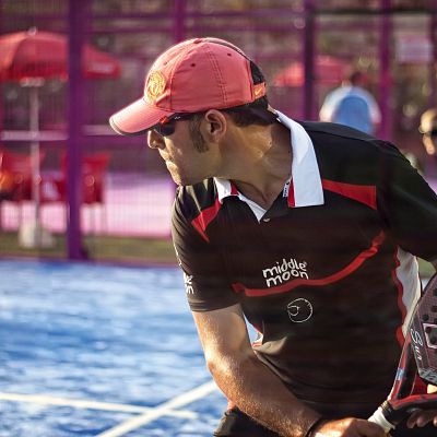
Paddle
Paddle tennis is one of the most popular sports in Spain thanks to its dynamism and its ability to be enjoyed as a couple. With numerous brand new courts recently built to practice it at any time of the year under the Mojácar sun, this sport has replaced tennis as the king of rackets generating a real passion.
The game consists of using the paddle to pass the ball to the opponent's court allowing only one bounce in our court and playing with the walls that surround the court. If we manage to stop our opponent from returning the ball to our court, we win the point. Have you really not tried it?
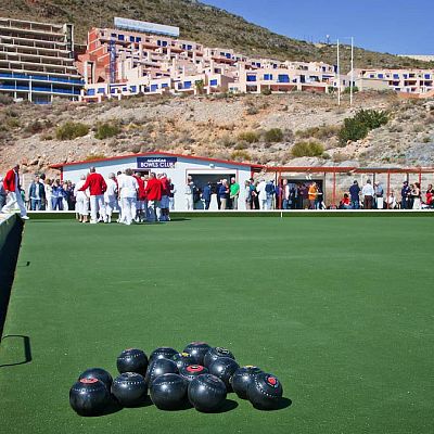
Bowls
Lawn bowls, also known as lawn bowls or bowls in the UK and Australia, where it is a very popular sport, is a precision game whose objective is to slide balls that are somewhat asymmetrical so that they are as close as possible to a smaller white ball (called "jack", "kitty", "gato" or "sweetie"), something similar to traditional Spanish petanque!
Numerous players from Northern European countries choose Mojácar to play this sport thanks to the facilities of the Mojácar Bowls Club and the fantastic climate of the Costa de Almería which makes playing this sport during the winter a pleasant outdoor experience.
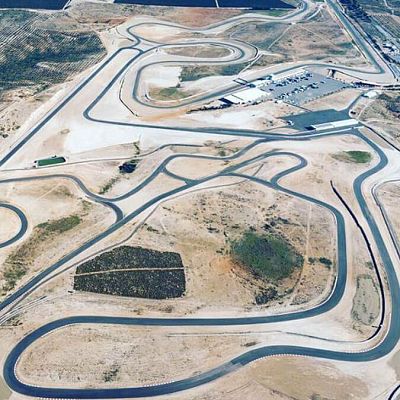
Motor
The area of Mojácar and the whole of the province of Almería offer the possibility of carrying out a complete selection of driving activities in the mountains or by the sea on dirt tracks, roads or on the best circuits.
The Andalusia Circuit, very close to Mojácar, is a reference point for motorcycling at an international level, a safe resource for the organisers of events who seek to avoid rain at all costs, which has served as a guarantee for hosting competitions of all kinds. Not to mention the excellent qualities and conditions of a track that stretches over 5,020 metres.
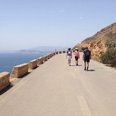
Hiking
Mojácar offers endless possibilities when it comes to hiking thanks to its marvellous combination of sea and mountains. In addition, the climate of the coast of Almería, mild throughout the year and with little rainfall, together with the landscape, ensures an absolutely pleasant experience for walking and enjoying physical activity.
In the area around the municipality there are a wide variety of routes of different distances and physical demands so that you can choose the one that best suits your profile. Whichever route you choose, you can be sure that the views will not disappoint you - it's hard to believe that so many different landscapes surround the ancient town of Mojácar!
Nearby hotels
Discover other Servigroup Hotels located in Mojácar and find the accommodation that best suits your trip. Different options to enjoy your stay with the quality and service of Servigroup.
Hotel Servigroup Marina Mar

Hotel Servigroup Marina Playa
Other activities that may interest you
Discover other activities and options you can enjoy during your stay. Ideas to continue exploring the destination and make the most of every moment of your vacation.


