A walk through La MangaThis extension of land with 21 km long and 300 meters wide, separates the Mediterranean Sea from the salt-water lagoon that is in its interior, the Mar Menor.
La Manga boasts of some great landscapes and corners to visit. The 7500 meters route to discover the most important places in the locality, begins in the Entremares Square Shopping Center. On the Gran Via Avenue you continue along the promenade to get to Cabo de Palos. Then the hiker finds a junction with traffic lights and must take the road that indicates the climb to the lighthouse, a route which passes by the port.
Strolling along the Levante beach reaching the Holoturia Street, the road leads to the parking area of the lighthouse. Continuing South on Santa Elena Street and taking a West turn until you reach the Cabo de Palos Port.
The Paseo del la Barra promenade goes around the whole port where you can get a view of the church. Once here, you go behind the Barra Promenade until you arrive to Palmeral Street, a road that runs from South to North until the Punta de la Azohia Street, where you take a left turn to meet up with the road that leads to La Manga. From here starts the return journey to the Entremares Shopping Center.
- Lenght: 7500 meters
- Duration: 1h 45min
- Type of route: Streets
- Dificulty level: Low
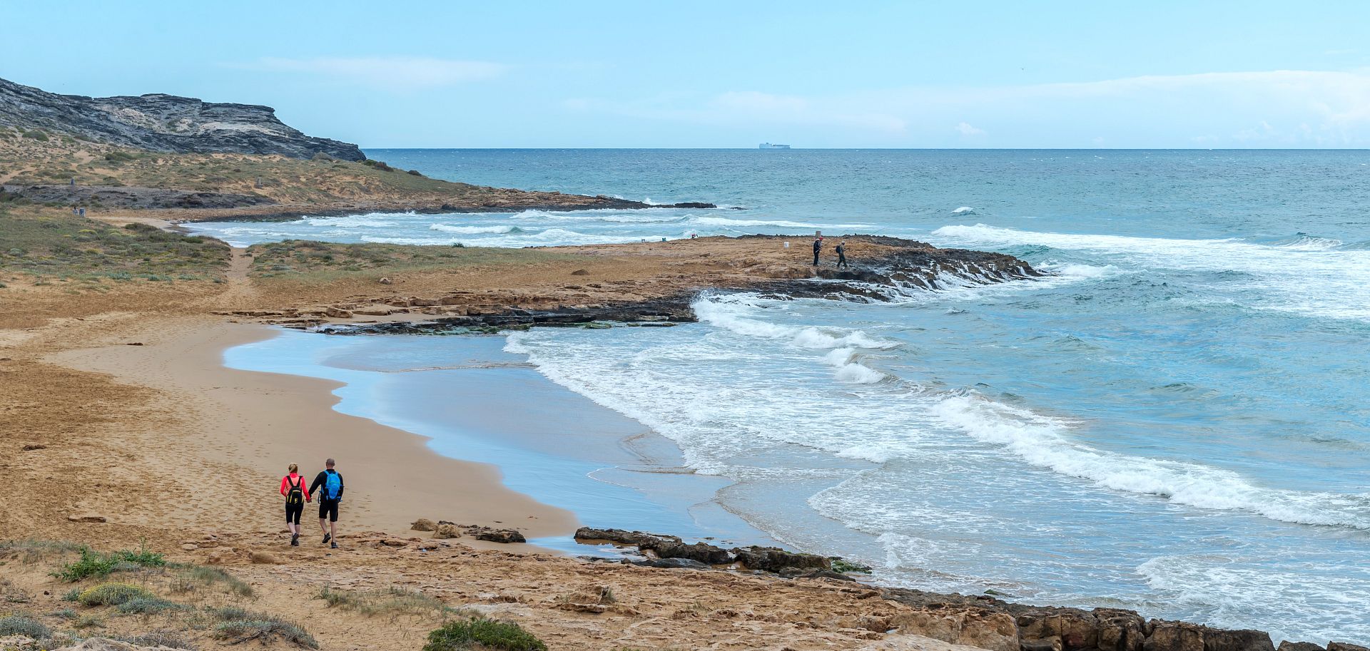
Los Belones - AtamariaBy car take the MU-312 El Algar - Cabo de Palos road, to arrive to Los Belones. Once here, drive along the old road that goes through the town and at the fourth cross-roads there is a road that goes south to La Fuente underground spring, where it is advisable to park your car. At this time, the route starts with a track heading South-West and we arrive at old abandoned Guardia Civil army barracks, here the path branches off the road and you have the option of going East or West. You choose the path that leads to the West and after a few meters, you take a downward path heading South to Cala de las Mulas. Near to this cove, a path stretches along the whole coastline between cliffs and small coves.
During approximately one kilometer, the tour is horizontal and then begins to rise until you reach the hill, from which it descends toward the Barco cove or alternatively towards the Golf Course complex. The object is to reach the summit of the mountain by the clearly signposted path. Once at the top, we have various views of: the Mediterranean Sea, the sports complex and the golf course, as well as the Mar Menor. All of this, accompanied by the gentle sea breeze.
To reach the end of the route, the hiker takes the West direction and borders an area of forest to bind with a track that leads to the Portman – El Llano del Beal, where the tour ends.
- Lenght: 6,5 km
- Duration: 2 h 30 min - 3 h 30 min
- Type of route: Track
- Dificulty level: Low
Los Belones – Cablanque – Cala ReonaAs in the previous route, take the MU-312 The Algar - Cabo de Palos road to reach Los Belones. Once here, driving along the old road that crosses the town and at the fourth cross-roads on the right, you take a road that leads to La Fuente underground spring. The route begins on foot taking the right hand side path which borders the cabezo and going South towards the sea, the hiker passes through traditional farmlands of Cartagena.
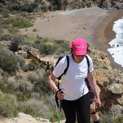
Suddenly, the walker finds himself on the highest point of the route, 145 meters above sea level, where there are abandoned army barracks of the Guardia Civil. Continuing along the hill toward the East, begins the descent on a narrow path surrounded by thickets, palm and pine trees, which leads to the vicinity of the sea, in Punta Negrete. Here, there is a trail along one of the largest sandy beaches. On descent the Salinas de Calblanque or Rasall lagoons come into view, the habitat of newborn chicks. Abandoning this trail and changing direction, one is directed towards Calblanque, a place where the road climbs through the mountains and where there are some old mining buildings and exploitation wells (extreme caution). The trail runs along the entire coast with a dramatic cliff that gives you spectacular views of the sea, of Cabo de Palos and its lighthouse.
Consequently the descent begins to the Reona Cove and here the tour ends (a swim in its crystal waters is recommended).
- Lenght: 10 km
- Duration: 3 h - 4 h
- Type: For trekking
- Dificulty level: Low
Portmán – El Llano del BealTo reach the start of the route, take the Cartagena – La Union road as far as the Esperanza village you take the slip road N-345 to get to Portman. Here, we can observe a mining landscape, abundant in iron pyrites and flints dressing the mountain with colour and reflections that change with the light.
The first stop is Portman, a small village that the hiker crosses which will lead to the roman town called Paturro, recommended to visit.
The path starts from the junction of the road until Atamaria and the golf course taking you to Portman. The path starts on the right and goes up a small track dominated by pine trees and aromatic plants
In this first phase, the path is very narrow and paved with stone, because it is a roman road that takes us back to history when the romans exploited the mineral wealth. In particular, it is the longest roman road in Cartagena with 1 km in length and a width of up to 3 meters.
Later, the roman road turns to the left and continues to reach a paved road which leads to the port. Four kilometers after starting the route, you will go up to 241 meters, the highest point in the road. From here, you see the mining lands, Portman, the Mar Menor Sea and the El Llano
In the last phase, on the descent, the landscape changes and the vegetation gives way to a desert landscape replete with mineshafts (caution: mining wells abandoned). The hiker follows the signs for the El Llano and in the 6.5 km ends the tour reaching the village.
- Lenght: 6,5 km
- Duration: 2 h - 3 h
- Type of route: Track
- Dificulty level: Low
Cartagena – Atalaya CastleThe route starts in the urban area of Cartagena. In the Spain Square, the hiker is directed toward the Real Street and across the Benipila rambla arriving to the Concepcion neighborhood. Just at the Church, the road turns to the right and then you are in the Quitapellejos precipice. From this moment the foot path to is along the edge of the rambla. Reaching some quarries of yellow clay, crossing near to an old barbed wire fence. Here the road is narrow and you start to see the vegetation of pine trees, pilgrim, etc.
The path to the left leads to the Pelayo sierra and on the right to the Atalaya Castle. Once in the latter, it descends North overlooking the Cartagena countryside. Now the vegetation is accompanied by the aromatic plants, thyme, pilgrim, etc.
The rambla tapers and along the lower share some mines. At the bottom of the valley there is a fence around a military compound. Here the path becomes larger and in a westerly direction, walking parallel to the same. Upon arriving at the Villaba houses area, go around the first paved road to the right and through a small lower appears a religious recinct. Then a steep slope leads up to the access road to the Atalaya Castle, from where you can enjoy views of the city, the port, the Cartagena camp and Mar Menor Sea.
To return to the origin point, take the same track to finish at the Conception neighborhood.
- Lenght: 5,5 km
- Duration: 2 h 30 min - 3 h
- Type of route: Streets / For Trekking
- Dificulty Level: Low